If you are looking at land west of Calgary and wondering whether it can be subdivided, the real question is not just how many lots might fit on paper. It is whether the site aligns with today’s planning framework, road access expectations, and servicing realities. For investors, landowners, and families exploring long-term value, understanding those filters early can save significant time and cost. Let’s dive in.
Start With the Planning Stack
For country residential subdivision near Calgary, the first step is to confirm where the land sits within Rocky View County’s planning framework. The County’s Municipal Development Plan, adopted on September 16, 2025, is the highest-order statutory plan, and Area Structure Plans sit below it.
Those Area Structure Plans outline proposed land uses, density, major roads, public utilities, and other matters Council requires. Rocky View’s own redesignation and subdivision guide makes an important distinction here: statutory plans are binding, while non-statutory plans are guidance only.
In practical terms, that means subdivision potential starts with policy fit before it moves to lot layout. If the land does not align with the applicable statutory framework, the rest of the exercise becomes far more uncertain.
Regional Rules Changed in 2025
The regional planning backdrop around Calgary shifted in 2025. The City of Calgary states that the Calgary Metropolitan Region Board regulation was repealed effective at the end of April 2025, which suspended conformity with the former growth and servicing plans. You can review that change on the City’s regional growth planning page.
Rocky View County now relies on intermunicipal development plans and collaboration frameworks with bordering municipalities. The same regional update notes a May 2025 ministerial order requiring intermunicipal development plans with boundary municipalities, including Calgary and Cochrane.
For you, this means subdivision analysis near Calgary’s edge now depends heavily on the current county plan, local statutory plans, and municipal coordination. The regional picture matters, but site-specific planning documents matter more.
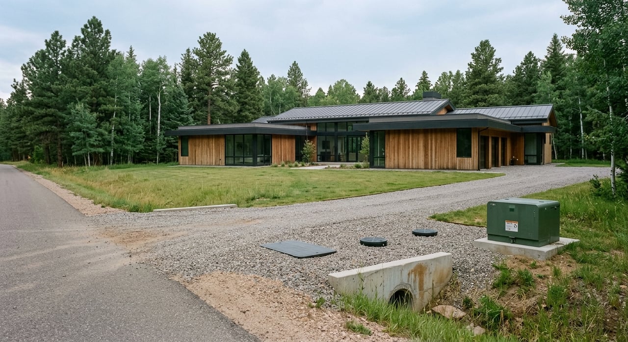
Bearspaw: Access and Servicing Matter Most
Bearspaw remains one of the most closely watched areas for estate and country residential land near Calgary. The new Bearspaw Area Structure Plan was adopted on June 17, 2025, replacing the older 1993 framework and the Ascension conceptual scheme.
One key reason for the update was to modernize policy and address road-access issues for parcels near the municipal boundary with the City of Calgary. That is a strong signal for landowners and buyers: access is not a minor detail. It can be one of the issues that shapes whether subdivision is workable at all.
Servicing is just as important. According to Rocky View County’s Bearspaw community page, most properties are served by water co-ops, while wastewater is generally handled through private septic or pump-out systems.
Because Bearspaw is a decentralized-servicing area, subdivision feasibility often turns on practical infrastructure questions. A parcel may look promising from a size or location standpoint, but if water, wastewater, or road access cannot be resolved, the subdivision path may narrow quickly.
Springbank: Piped Infrastructure Is a Bigger Filter
Springbank has a different planning profile. The new Springbank Area Structure Plan, approved on March 25, 2025, consolidates earlier plans and maintains Springbank as a country residential community with single-detached homes on lots generally 2 acres in size.
What makes Springbank especially important for subdivision analysis is its more explicit infrastructure direction. The plan states that new residential areas must connect to piped water and either regional or decentralized piped wastewater at subdivision, and deferrals of piped connections are not to be considered.
That is a major practical filter. Even though much of Springbank’s existing utility pattern remains rural in character, with Rocky View noting that most of the area uses water utilities or co-ops and wastewater is commonly handled by septic or pump-out systems, new subdivision areas face a clearer servicing threshold.
The Springbank ASP also requires transportation impact assessment work at the local-plan or subdivision stage and says the road network should align with the ASP map. So if you are assessing a site in Springbank, you are not only reviewing acreage and frontage. You are reviewing the cost and feasibility of water, wastewater, and transportation compliance together.
Cochrane Corridor: One Region, Different Rules
Buyers and investors often group the broader Cochrane corridor into one market conversation, but planning rules vary depending on whether the land is in the Town of Cochrane or in Rocky View County.
Inside the Town, Cochrane’s land use bylaw sets districts, uses, setbacks, lot sizes, parking, and overlays. The Town also notes that subdivision applications must comply with the bylaw and may require servicing plans or traffic impact assessments.
The Town’s Bow River Strategy, approved on February 9, 2026, adds a long-term framework for the river corridor. It does not approve specific projects or replace statutory plans, but it can add another layer of environmental stewardship and access review for corridor sites.
On the county side, the Cochrane North ASP says development should proceed in phases based on prior conceptual schemes and the availability of sewer, water, and transportation servicing. It also notes that interim servicing strategies are generally not supported.
The takeaway is simple: proximity to Cochrane does not create a single approval environment. You need to assess each parcel in its actual municipal and statutory context.
ASPs Guide Growth, Not Timing
A common mistake in land analysis is treating an Area Structure Plan like a guarantee that subdivision can happen soon. In reality, an ASP is a roadmap, not a promise of timing.
Springbank’s ASP says growth is ultimately driven by market demand. That matters because a site can align with policy direction and still face timing, phasing, infrastructure, or market-related constraints.
For you as a buyer or investor, this is where patience and realism become part of the strategy. A parcel with long-term potential may still require staged expectations around approvals, servicing, and absorption.
Due Diligence Before You Assume Lot Yield
Subdivision value is often discussed in terms of possible lot count, but that number should never be treated as settled too early. Rocky View’s subdivision process reviews land designation, number of lots, access, stormwater, and water and wastewater servicing.
That means due diligence should begin with a disciplined sequence:
- Confirm the planning framework through the Municipal Development Plan, applicable intermunicipal plan or ASP, and any conceptual scheme or master site development plan where required.
- Test road access early because Rocky View specifically reviews whether land is accessible by road.
- Assess servicing feasibility for water, wastewater, and stormwater before assuming subdivision economics work.
- Review environmental constraints that may affect developable area or reserve requirements.
- Engage the municipality early through a pre-application meeting for complex proposals.
Rocky View also explains that conceptual schemes help ensure subdivision design does not block future subdivision of remnant or adjacent parcels. That can influence layout, circulation, and yield in ways that are not obvious from a simple site sketch.
Environmental Constraints Can Reduce Yield
Even when planning policy appears supportive, environmental factors can change what is actually achievable. Alberta’s municipal planning referrals guidance notes that subdivision referrals can trigger environmental reserve requirements, especially around wetlands, streams, flood-prone land, unstable land, and other water bodies.
That is why drainage, slope, riparian edges, and habitat should be reviewed before you rely on an assumed lot count. A parcel’s gross area may tell only part of the story. The more relevant question is how much of the site remains practically and legally usable after constraints are mapped.
Why Early Professional Review Matters
Country residential subdivision near Calgary is rarely a one-discipline exercise. Policy fit, servicing, access, environmental review, and subdivision design all interact with one another.
Rocky View recommends pre-application meetings for complex proposals, and its process shows that approval, conditions, appeal, and registration all depend on the statutory framework being satisfied. For investors and landowners, early review with the right team can prevent expensive assumptions and identify the strongest path forward.
That is especially true in Bearspaw and Springbank, where estate-scale land values can make both upside and risk meaningful. A careful review can help you distinguish between land that is simply attractive and land that is realistically actionable.
If you are evaluating country residential subdivision potential near Calgary, working with a team that understands local planning, site dynamics, and development-oriented analysis can give you a clearer starting point. Bearspaw Real Estate offers boutique guidance for acreage, estate, and select land opportunities in Bearspaw, Springbank, and the surrounding Calgary market.
FAQs
What planning documents matter for subdivision near Calgary?
- The key documents usually include Rocky View County’s Municipal Development Plan, the applicable Area Structure Plan or intermunicipal development plan, any required conceptual scheme or master site development plan, the Land Use Bylaw, and the subdivision application requirements.
What makes Bearspaw subdivision potential harder to assess?
- Bearspaw subdivision potential often depends heavily on road access and decentralized servicing, since most properties use water co-ops and wastewater is generally managed through private septic or pump-out systems.
What servicing rules apply to Springbank subdivision land?
- Springbank’s current Area Structure Plan says new residential areas must connect to piped water and either regional or decentralized piped wastewater at subdivision, and deferrals of piped connections are not to be considered.
What can reduce lot yield on country residential land near Calgary?
- Environmental reserve requirements, wetlands, streams, flood-prone land, unstable slopes, road access issues, and servicing constraints can all reduce the number of lots a site can realistically support.
What is the first due diligence step for land near Calgary with subdivision potential?
- The first step is to confirm the full planning stack for the parcel, then test access, servicing, and environmental constraints before assuming timing, approvals, or lot count.